Major cities, including Los Angeles and Atlanta, may experience increased rainfall, flooding, and other disruptive weather conditions this winter. El Niño is set to strengthen, bringing the possibility of a robust impact, according to AccuWeather expert Paul Pastelok.
El Niño Explained
El Niño represents the warm phase of the El Niño-Southern Oscillation (ENSO), a recurring climate pattern in the Pacific Ocean influencing global weather. The opposite phase is La Niña, characterized by its cooling effects.
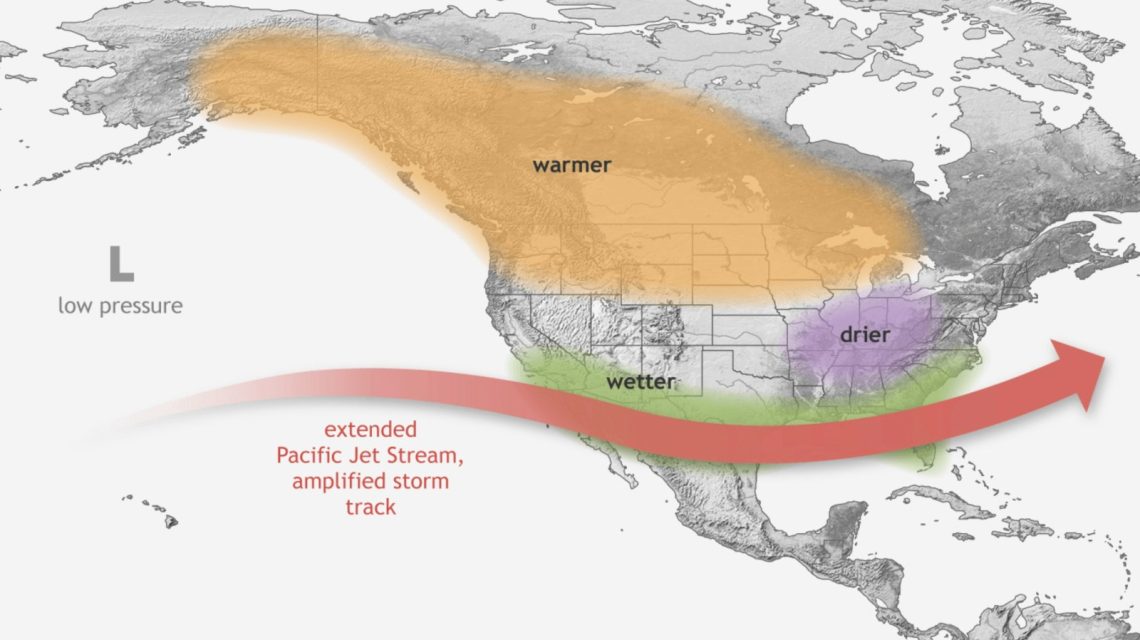
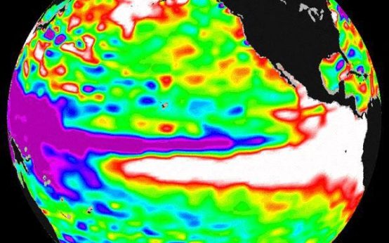
El Niño typically prompts stormier conditions in southern regions, reduced rainfall in some northern areas, and affects hurricane activity. Intense El Niño events have historically led to severe weather extremes. The 1997-98 Super El Niño, for example, resulted in severe flooding in California and Peru. The 2015-16 event was linked to global temperature peaks and widespread climatic disruptions.
Cities Most Affected
With El Niño’s expected dominance, cities such as Los Angeles, San Francisco, Houston, and Atlanta could experience increased rainfall and flooding. A southern storm track generally impacts these areas more frequently during late fall and winter. California’s landscape, in particular, poses a risk for landslides.
River levels along the Mississippi, Tennessee Valley, and the Carolinas may rise rapidly, affecting cities along these routes. East Coast storms, during El Niño episodes, have historically led to coastal flooding and high winds in cities like Norfolk, Virginia, Atlantic City, and Boston, Massachusetts.
NOAA’s Winter Predictions
Maps from the National Oceanic and Atmospheric Administration’s (NOAA) Climate Prediction Center (CPC) outline forecasts for December 2026 to February 2027. The temperature outlook suggests above-normal conditions across regions from the Pacific Northwest and northern Rockies to the Plains, Midwest, and Northeast, with the strongest warm signals in the northern tier.
Above-normal temperatures are anticipated throughout much of the South, although the outlook is less definite for California and the Southwest.
The precipitation outlook indicates wetter-than-normal conditions from Southern California, across the Southwest, southern Plains, Gulf Coast, and extending through Florida and portions of the East Coast.
The CPC’s recent update indicates a 75 percent chance of El Niño reaching historic strength between October and December, surpassing previous events recorded since 1950. This probability has climbed from 69 percent noted in August. Despite the potential for typical El Niño impacts, such effects are not assured, even with an event of significant magnitude.
 Atlantic Ends September Without a Hurricane for First Time Since 1994
  Bobcat Sightings and Conservation Efforts in Illinois
  2026 El Niño: A Historical Comparison and Future Projections
  U.S. Records Warmest September in History
  Swiss Glaciers Show Effects of Ice Loss Amid Global Warming
  Climate-Resistant Rock Glaciers: Hidden Water Resources