Hurricane Karina Strengthens in Eastern Pacific
Hurricane Karina has developed into a formidable Category 4 storm, sweeping across the eastern Pacific. The National Oceanic and Atmospheric Administration’s National Hurricane Center (NHC) has issued warnings regarding the swells created by Karina. These swells are anticipated to move northward, affecting Southern California with hazardous surf and rip currents.
Swells generated by Karina will impact southwest Mexico and Baja California Peninsula over the next few days. They are expected to extend further north to Southern California from Monday to midweek, posing significant threats.
While Karina itself is not expected to approach California directly, its generated swells pose potential dangers. Currently, the storm is moving west, deeper into the Pacific, around 1,020 miles west-southwest of Baja California’s southern tip. NHC reports the hurricane as having maximum sustained winds of 145 mph, progressing west at 9 mph. No coastal alerts are presently active.
Tracking Hurricane Karina’s Progression
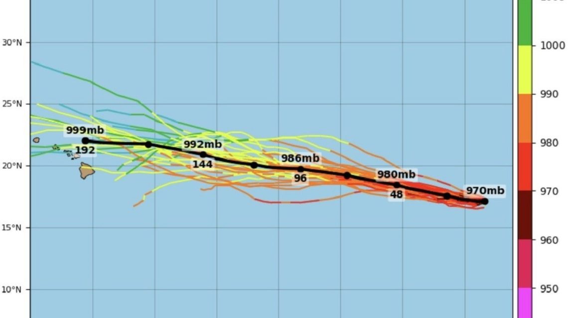
Newsweek recently reached out to NOAA for comments on the situation. The Tropical Tidbits platform provides spaghetti-model guidance showing Karina continuing a generally westward path across the Pacific. Forecast tracks indicate that the hurricane’s center will remain offshore from both Mexico and California.
The data uses various acronyms, such as GEFS for Global Ensemble Forecast System, which offers multiple forecast variations to demonstrate potential storm trajectories. MSLP represents minimum mean sea level pressure, with ‘mb’ denoting millibars as the measure of atmospheric pressure, while ‘hPa’ stands for hectopascals. Lower MSLP often signifies a more intense storm.
Preparing for Dangerous Surf Conditions
As per NHC’s latest forecast, Hurricane Karina is projected to move westward on Monday and then shift west-northwest on Tuesday. The hurricane will maintain its position over the Pacific Ocean.
Swells will influence southwest Mexico and Baja California Peninsula before potentially expanding to Southern California between Monday and midweek. These swells could result in perilous surf and rip currents, according to warnings by NHC.
Hurricane’s Position and Movement
By 0900 UTC Monday, Hurricane Karina was positioned near 17.2 degrees north latitude and 124.4 degrees west longitude. The storm was advancing west at approximately 8 knots, featuring maximum sustained winds of 125 knots and gusts peaking at 150 knots, as stated in NHC’s advisory.
Additional strengthening of the hurricane was predicted for Monday, with possible fluctuations in intensity throughout the week.
Beachgoers Cautioned on Surf Conditions
Individuals planning beach visits in Southern California should remain updated with the latest forecasts and warnings from local weather offices as swells approach. NHC specifically urges consulting local weather services for detailed surf and rip current warnings.