Development of Tropical Storm Isaias
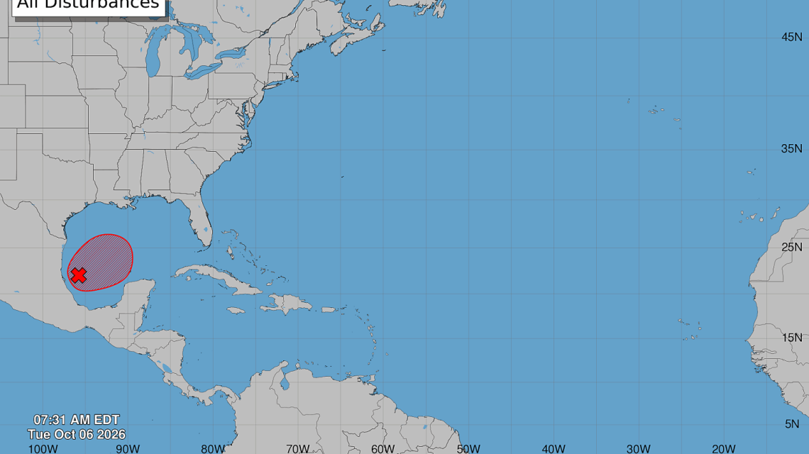
A tropical disturbance in the Gulf of Mexico is poised to become Tropical Storm Isaias. Forecasters are tracking its path toward the United States, predicting possible impacts by the end of the week. Expect flooding rain, storm surge, damaging winds, and isolated tornadoes in parts of the Gulf Coast.
Communities from eastern Louisiana to the Florida Panhandle are advised to stay updated on forecasts. The National Hurricane Center is monitoring Invest 92L, situated in the Bay of Campeche, and assigns a high probability of tropical development. Hurricane Hunter aircraft are evaluating the disturbance to gauge its strength and landfall location.
Isaias’s Potential Path
Spaghetti models suggest a likely landfall on the northern Gulf Coast. Tracks cluster between eastern Louisiana and the Florida Panhandle. While models diverge on precise landfall, consensus focuses on this coastal stretch.
Meteorologist Matt Devitt notes the greatest potential for landfall is from eastern Louisiana eastward. AccuWeather’s Alex DaSilva indicates slow movement in the Bay of Campeche remains possible but is diminishing.
Current Projections and Forecasts
AccuWeather projects highest risks for Mississippi and Alabama coastlines. Exact landfall and timing should become clearer once a defined center forms.
Forecast models show the storm’s center forming closer to the Gulf coast as projections shift from Mexico to the U.S. Accordingly, residents should prepare for impacts beyond the forecast line. The storm may impact areas outside its predicted path, especially with an asymmetric structure.
Landfall and Intensification Risks
Forecast steering currents suggest a north-northeastward path. Prevailing winds focus the track on the central Gulf Coast. Projections favor a landfall near southeastern Louisiana, coastal Mississippi, or the Florida Panhandle. Swift adjustments in the storm’s path could change the impact zone.
Factors such as location, atmospheric conditions, and intensification speed affect the storm’s path. Forecasters advise checking updated paths, as hazards often extend far from landfall locations.
Intensity and Threats
Warmer Gulf waters support intensification, but wind shear could influence storm strength. AccuWeather expects Isaias to reach hurricane strength, though weakened by northern Gulf Coast wind shear.
Hurricane Hunter aircraft will examine the storm’s current state. A few scenarios still indicate the chance of a stronger cyclone, urging continued monitoring.
Flooding and Tornado Concerns
Water hazards may pose the greatest threat. Expected rainfall might cause flash flooding and river swellings. Areas with persistent rain face increased flooding risks, especially since some have already experienced recent storms.
Storm surge threatens vulnerable coastal areas, with strong winds pushing water inland. Forecasts predict 1 to 4 inches of rainfall, with higher amounts in certain areas.
Tornadoes are possible, especially east of the storm’s center. Preparations for potential tornadoes in coastal areas are advisable.
Official Recommendations
The National Hurricane Center tracks the system as Invest 92L and prepares to classify it as Tropical Storm Isaias once criteria are met. Key forecast information requires further structural development.
Gulf Coast residents should review hurricane plans and ensure supplies for potential warnings or evacuations. Familiarity with local evacuation directions is prudent for those in vulnerable areas.