Students at Indiana University Northwest, led by Professor Joe Blockland, are utilizing technology to assess the health of over 400 trees on campus. An app created by Blockland aids this effort, allowing students to identify trees with issues like cracked trunks or insect damage.
According to Blockland, the aim is practical application. Students in his GIS class are learning through hands-on experience. They have already mapped approximately 130 trees. The app also serves as a tool for understanding how it can benefit local communities and other campuses.
“Each time they go out, they get a little bit better at it,” Blockland stated, expressing optimism about the work being done.
The app’s development was inspired by Blockland’s personal experiences. He previously worked in tree servicing, gaining insights that helped in creating the app. His students also contribute by identifying important assessment categories. This approach provides them with valuable job opportunities and skills relevant to the GIS job landscape.
Blockland notes the growing demand for applications capable of collecting field data. Examples include Ducks Unlimited and Shirley Heinze Land Trust, which assess culvert conditions using similar technology. Government and municipal bodies could adopt such apps to address local issues. For instance, citizens could report potholes by sharing photos, and GIS specialists could locate them precisely for repair.
The use of telemetry devices and real-time data collection can also be found in organizations like the U.S. Geological Service. They gather water level data along certain rivers, aiding in flood forecasting.
GIS technology has advanced since Blockland first encountered it as an undergraduate. Despite initial challenges with computer reliability, the potential benefits became clear during his graduate studies. Today, advanced tools, such as AI, help map areas more efficiently. While manual mapping remains more precise, these tools offer a significant time advantage.
“For entry-level positions, companies demand candidates proficient in AI tools and dashboards,” Blockland explained, highlighting market expectations.
Salaries for GIS specialists vary, starting from $50,000 and rising with experience. After five years, specialists can earn upwards of $90,000. Blockland’s program offers a four-course GIS certificate to equip students with necessary skills. Students from various majors, including environmental science, psychology, and art, are engaging with GIS to harness its potential creativity.
Environmental GIS courses cover essential topics like mapping flood hazards and risks associated with natural disasters. Programming classes teach skills in Python for automating workflows, enabling efficient data handling. Through practical and advanced coursework, students gain insights into GIS applications.
GIS technology holds promise beyond academics. Students’ current projects, like assessing campus trees, spark interest in the field, preparing them for future opportunities.
 The Daily Routine of Klook’s CEO Focused on Fitness and Efficiency
 The Jensen Huang Controversy: Silicon Valley’s Divided Opinion
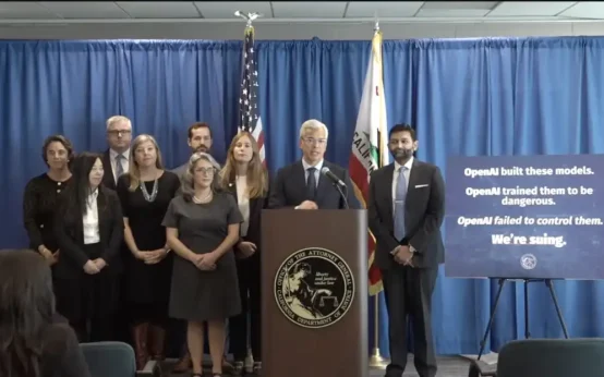 California Lawsuit Against OpenAI: Key Details and Implications
 Updates on Key International and Domestic Events
 E.l.f. Cosmetics Breaks Makeup World Record at TwitchCon
 Understanding Credit Freeze, Fraud Alert, and Identity Monitoring