
Recent coastal flooding from Newport Beach to Long Beach was caused by a rare mix of events that highlights the issues California faces amid the forecast of a strong El Niño winter. The flooding was notable for its severity, and scientists explained that factors such as the approaching Tropical Storm Rachel, high tides, an unusually warm ocean, and waves driven by El Niño can overwhelm coastal regions.
Jonathan Warrick, a research geologist with the U.S. Geological Survey, emphasized how unprecedented the situation is, stating, “The combination of high tides, Kelvin wave, hurricane waves — and then a whole summer’s worth of that? This is unprecedented.” Looking ahead, California might face a prolonged El Niño season with potential winter storms and high tides during the holidays.
Tropical Storm Rachel was predicted to hit northern Baja California, potentially increasing flood risks along the Orange County and San Diego coast due to high swells, onshore winds, and elevated tides. High tide times were set for Sunday morning, at 9:43 a.m. in La Jolla and 9:48 a.m. in Newport Beach. Warrick and other experts believe these events might indicate future patterns.
“I won’t say 100% sure we’re going to see this this winter, but this is a type of thing we may see a lot more of this winter,” Warrick stated.
The year’s highest tides are expected around the summer and winter solstices, with potentially destructive impacts if they coincide with strong winter storms. Reinhard Flick from the Scripps Institution of Oceanography warned about forthcoming king tides around Christmas that could potentially enhance El Niño’s effects.
Historically, major El Niño events have led to significant Southern California coastal damage, with strong storms leading to erosion and flooding. Notably, the recent flooding in Orange County resulted from Tropical Storm Rachel’s swells and an El Niño-induced Kelvin wave, which elevated background sea levels and brought warmer waters.
Dillon Amaya, an expert on Kelvin waves, pointed out another such wave heading toward Southern California. While the hurricane-induced storm surge significantly impacted flooding, the presence of the Kelvin wave made the situation more hazardous, according to Amaya.
Efforts to mitigate the impacts included building sand berms and using sandbags. The National Weather Service reported that tide levels on Saturday peaked at 7.7 feet, surpassing predictions by 1.6 feet, with Sunday morning tides forecasted to challenge previous records.
In historical context, only two storms at tropical-storm strength have struck California – the infamous “El Cordonazo” in 1939 and Nora in 1997. The latter occurred during a strong El Niño season, like the current one, which the National Oceanic and Atmospheric Administration predicts will be one of the most intense since records began in 1950.
Contributions to this report were made by Jasmine Mendez, Hannah Fry, and Jaweed Kaleem.
 Supreme Court Climate Lawsuits Pose Financial Risks to Oil Companies
 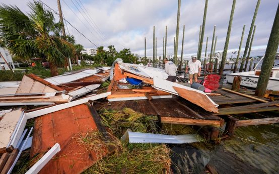 Impact and Aftermath of Hurricane Isaias Across Florida and Beyond
 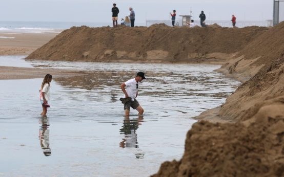 Coastal Flooding Impacts Southern California as Tropical Storm Rachel Approaches
 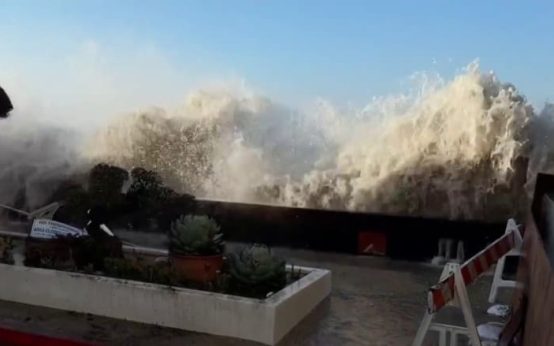 Hurricane Isaias: Widespread Impact on the Southeast
  Severe Weather Impacts: Hurricane Isaias and Its Aftermath
  Hurricane Isaias and Other Storm Updates