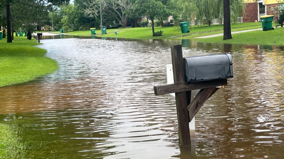
Record Rainfall on Kelleys Island
Kelleys Island, located in Lake Erie, faced an unusual weather event with heavy rainfall amounting to nearly four months’ average in under 12 hours. This deluge set an unofficial record for the island, emphasizing an increasing climate issue in the Midwest and Northeast U.S.
Between late Sunday and Monday morning, local weather sources and emergency officials recorded 13 to 16 inches of rain. The National Weather Service (NWS) issued flash flood warnings as water levels rose rapidly. Residents encountered flooded basements, submerged roads, and severe property damage due to this downpour.
The Impact on the Island
Kelleys Island typically receives about 4.1 inches of rain in July, said Brian Mitchell from the NWS. The recent storm delivered nearly four times this monthly average in just hours. The previous all-time rainfall record in Ohio, set in 1995, was 10.75 inches. It might take weeks for officials to verify and update state records following this event.
WTOL’s chief meteorologist Chris Vickers noted rainfall topped 17 inches, surpassing previous records and causing widespread flooding. Residents were advised to avoid flooded regions and use water cautiously. The rain exceeded the NWS 1-in-1,000-year event threshold, which is 8.41 inches in 24 hours for this area.
Jeff Berardelli, chief meteorologist at WFLA-TV, emphasized the rarity, describing the event as unforeseen under normal circumstances.
Videos online showed streets transformed into rivers with water cascading downhill, flooding properties extensively. The magnitude draws attention to a recurring concern: extreme weather patterns are becoming more frequent in the country.
Understanding a 1-in-1,000-Year Event
The Kelleys Island rain exemplified a “1-in-1,000-year” event. This term indicates a 0.1% yearly likelihood of such rainfall happening, based on historical data. Multiple such events can occur in short periods, reflecting probability rather than occurrence spacing.
Scientists note the warming atmosphere changes these odds. As warmer air retains more moisture, storms now yield heavier rains than before. Climate studies reveal that atmospheric water capacity increases by about 7% with every 1 degree Celsius rise in temperature.
The Broader Trend of Extreme Rainfall
This incident aligns with a national pattern of increasing heavy rainfall events. The U.S. Global Change Research Program and National Climate Assessment indicate that in the past century, the U.S. has seen a notable increase in extreme precipitation. The Midwest and Northeast are particularly affected.
Climate change doesn’t directly cause every single storm but shapes conditions that can lead to higher rainfall. The U.S. recently faced multiple “once-in-a-century” floods in short intervals, challenging old perceptions.
The Role of El Niño
Currently, El Niño—a climate pattern marked by warm equatorial Pacific waters—affects global weather, including U.S. precipitation trends. Yet, it doesn’t trigger individual storms. Kelleys Island’s flooding arose from a storm system repeatedly hitting the same region, known as “training” thunderstorms.
Future Actions for Kelleys Island
As water levels decrease, damage assessments will follow. Roads, businesses, and infrastructure might need repairs. Emergency teams will determine if more state or federal aid is necessary. The NWS Cleveland office reports no current weather alerts for the region.
 Swiss Glaciers Show Effects of Ice Loss Amid Global Warming
  Climate-Resistant Rock Glaciers: Hidden Water Resources
  Senators Reach Bipartisan Agreement on Permitting Reform
  Experts Warn of Critical Period for the Colorado River
  Future Cities: Ambitious Projects Aiming for Innovation and Sustainability
  Supreme Court Case Suncor vs. Boulder: Implications for Accountability in Climate Change