Floating Island in Williston Reservoir Located
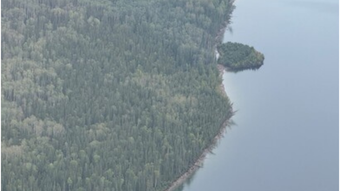
After causing intrigue by seemingly vanishing, a floating island in British Columbia’s Williston Reservoir has been found. BC Hydro reported the island drifted roughly 30 kilometers over 15 days, finally resting along the shoreline of the reservoir’s Ospika Arm.
Tracking the Elusive Island
Initially observed near Finlay Bay, the island disappeared, sparking curiosity and questions about its whereabouts. BC Hydro later confirmed its location, using satellite imagery, reports from boaters, and aerial observations.
“We found the island,” stated BC Hydro in a social media release, clarifying that the island had drifted rather than disappeared.
Chronology of Events
The island first appeared in satellite images on July 21. By August 13, local boaters alerted BC Hydro to its existence, though it had already moved. The island was eventually seen in new satellite imagery on August 15, about 30 kilometers northwest of its initial position. BC Hydro verified this on August 31.
Understanding Floating Islands
Floating islands consist of vegetation, soil, and organic matter, which allow them to float. Large examples supporting mature trees are rare. Formation could result from logs and debris accumulating and decomposing over time, enabling plant growth.
These floating masses intrigue researchers eager to learn about their formation and movement.
Island’s Journey
The island traveled approximately 30 kilometers from its documented start location. Satellite images confirmed its movement near the Ospika Arm, though real-time data was unavailable.
Now further from the W.A.C. Bennett Dam, BC Hydro does not expect operational issues due to the island’s current position.
Dimensions of the Island
The island spans about 459 feet by 230 feet—around the size of two NFL football fields. Despite its movement, it remains intact, with mature trees and thick vegetation.
Visiting the Island
BC Hydro advises against attempting to land on the island due to its unstable composition of logs and decaying debris. Visitors can photograph it from boats or drones.
Continued monitoring will aid researchers in understanding how the island formed and why it drifts. “While pleased to confirm the location, there’s more to learn,” said BC Hydro spokesperson Bob Gammer.
 Atlantic Ends September Without a Hurricane for First Time Since 1994
  Bobcat Sightings and Conservation Efforts in Illinois
  2026 El Niño: A Historical Comparison and Future Projections
  U.S. Records Warmest September in History
  Swiss Glaciers Show Effects of Ice Loss Amid Global Warming
  Climate-Resistant Rock Glaciers: Hidden Water Resources