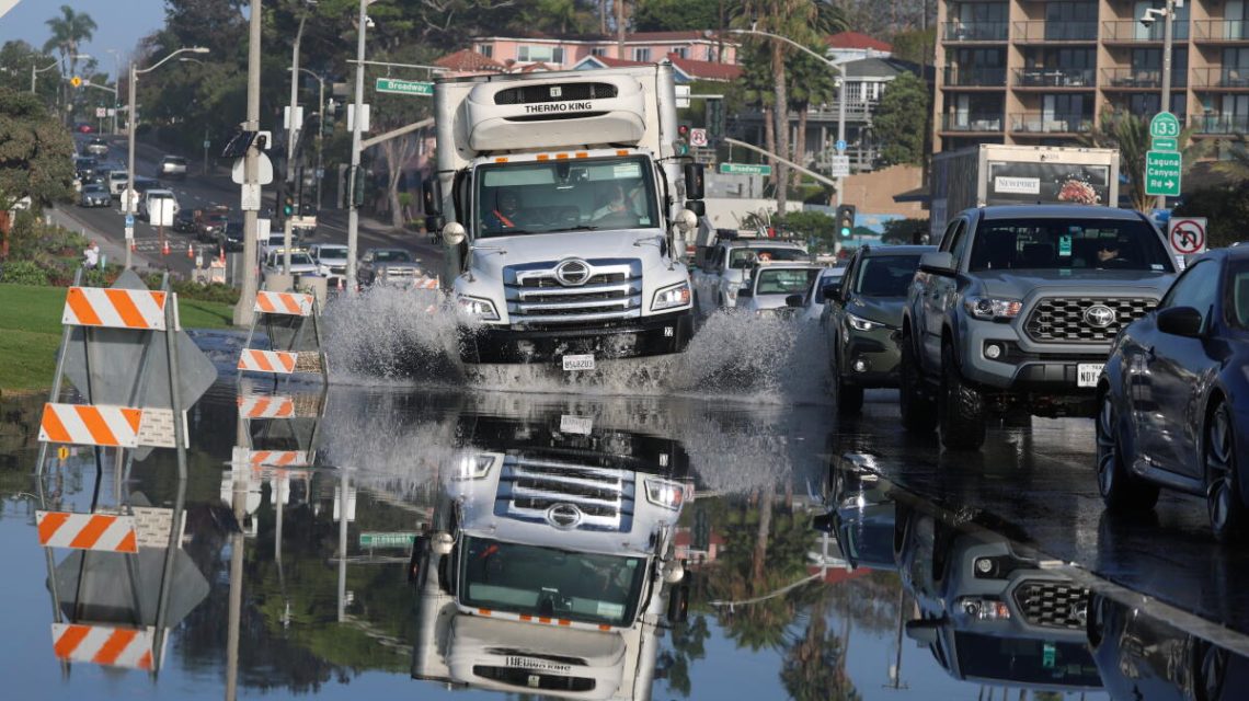
Tropical Storm Rachel is poised to make landfall in either northern Baja California or San Diego County by Saturday night. The National Hurricane Center has issued warnings about potential hazards, such as destructive coastal flooding. Rachel is spinning hundreds of miles off San Diego’s coastline and could intensify before reaching the West Coast, an unusual event for tropical eastern Pacific storms. Although these storms typically lose strength upon entering cooler waters, El Niño conditions and a marine heat wave have increased ocean temperatures by 10 to 13 degrees above normal, creating a favorable environment for Rachel.
It’s an unusual event made possible by record warm ocean temperatures and an early arriving low-pressure trough, said UC Agriculture and Natural Resources climate scientist Daniel Swain.
Where is flooding most likely?
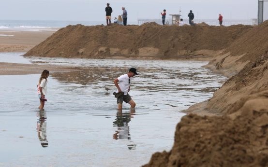
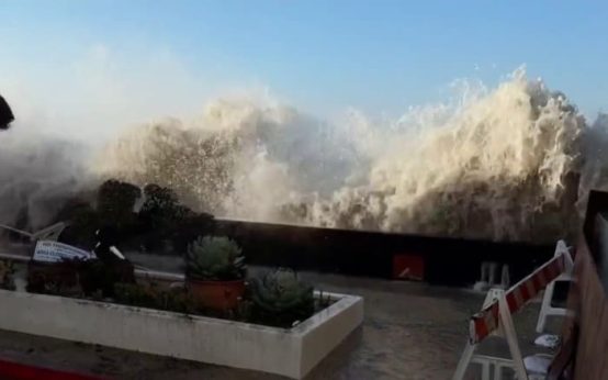
The National Weather Service in San Diego has issued a rare tropical storm watch for most of San Diego County, including San Diego, Chula Vista, Carlsbad, and Oceanside. This marks only the second time such a watch has been issued in California. The main concern for the region is coastal flooding, particularly on south-facing shores due to high tides, elevated water levels, and the incoming storm. Swells are expected to cause water intrusion and hazardous surf ranging from 3 to 6 feet, along with rip currents.
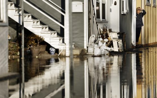
Laguna Beach residents experienced flooded streets in the city’s downtown area. Officials predicted tides would be 1 to 1.5 feet above normal, exacerbated by El Niño’s warm ocean temperatures. At 9 a.m. Friday, high tide in San Diego and La Jolla was 17 inches higher than official forecasts, which don’t account for warmer waters or tropical storm swells. Santa Monica’s tides were 16 inches higher, San Francisco’s were 14 inches higher.
Water levels are high, and we’ll have periods of high tides plus high surf, said Miguel Miller from the National Weather Service.
A coastal flood advisory for Ventura, Los Angeles, Orange, and San Diego counties warns of flooding in beach parking lots, boardwalks, and roads, with isolated road closures and minor coastal erosion expected through Tuesday afternoon. Cities like Laguna Beach, Newport Beach, and Long Beach have already faced significant flooding.
How much rain is expected?
Tropical moisture from Rachel’s remnants will likely bring light rain to much of Southern California from Sunday Morning through Monday night. However, areas such as the Mojave Desert, Inland Empire, and parts of San Diego County might receive significant precipitation. The weather service warns of a 40% chance of excessive rainfall, potentially causing flash floods in San Diego, El Cajon, Chula Vista, Escondido, Palm Springs, and Twentynine Palms.
Moderate risk suggests numerous flash floods are likely, with many streams possibly flooding. There’s a chance the San Diego River near Fashion Valley could reach a minor flood stage. Oceanside, San Clemente, Laguna Niguel, Riverside, San Bernardino, Las Vegas, the California-Arizona border has a 15% chance, while Huntington Beach, Santa Ana, Long Beach, Anaheim, Pomona, Victorville, Barstow, Arizona, and southern Utah face a 5% chance.
Los Angeles County expects light to moderate rain, ranging from a quarter-inch to an inch across the region. San Gabriel Mountains might receive more rain, with rain rates around a quarter-inch per hour, reducing the likelihood of debris flow and landslides. Orange County coastal areas could get between half-inch to an inch, with San Diego County coastal areas seeing between an inch to an inch and a half, with higher levels inland.
How common is a tropical storm in Southern California?
Since modern recording began, only two storms have identified as tropical-storm strength in the state. The first, El Cordonazo, struck Long Beach and San Pedro in September 1939, bringing 5.62 inches of rain, causing flood-related fatalities, and high tide-driven waves crashing into homes. In September 1997, Nora briefly reached tropical storm strength along the California-Arizona border yet spared California the level of damage it caused in Baja California. It resulted in street flooding in Imperial County, Coachella Valley, and San Diego. Waves from Nora and another storm damaged beachfront properties in Seal Beach, significantly impacting homes.
Nora arrived during a strong El Niño season, linked to increased hurricane activity in the eastern Pacific and associated with higher-than-average winter rainfall in Southern California. El Niño entails heating ocean waters, altering the atmosphere and affecting global weather. The National Oceanic and Atmospheric Administration’s Climate Prediction Center forecasts a 100% chance of this El Niño being classified as “very strong,” with an 83% record-strong chance. Since 1950, four “very strong” El Niños have occurred: 1982-83, 1991-92, 1997-98, and 2015-16.
The Missouri pattern during strong El Niños can inflict impacts consistent with El Niño overall, though not guaranteed, the Climate Prediction Center detailed.
The 1982-83 and 1997-98 El Niños delivered over 30 inches of rain to downtown Los Angeles, doubling the area’s average yearly rainfall. The 2015-16 El Niño yielded half of this rainfall but led to record coastal erosion. The California Coastal Commission recorded erosion along numerous beaches.
 Hurricane Simon Approaches Mexico’s Pacific Coast as Category 4
  Unusual Factors Lead to Coastal Flooding in California
  Supreme Court Climate Lawsuits Pose Financial Risks to Oil Companies
  Impact and Aftermath of Hurricane Isaias Across Florida and Beyond
  Coastal Flooding Impacts Southern California as Tropical Storm Rachel Approaches
  Hurricane Isaias: Widespread Impact on the Southeast